THERE is no safe side of the map this time. Unlike a tropical cyclone, which can leave one island battered and another untouched, a major El Niño moves through the Pacific like a pressure felt in every home, farm, harbour and water tank.
“When you have the El Niño, everyone is affected,” Ocean Science Officer with the Pacific Community (SPC), Dr Moleni Tu’uholoaki, says. “You can’t escape.”
That warning is especially urgent because the developing event is being watched as a possible record-setter for the satellite era, which began in the 1960s. Its peak is expected around November or December, Tu’uholoaki says, but its consequences will not arrive in one uniform wave.
History is the reason he urges caution. In Tonga, the 1982–83 El Niño brought severe drought and famine. Later, strong events, including 1997–98 and 2015–16, did not produce the same agricultural disaster. Sea-surface temperatures around Tonga were cooler during some earlier events, but warmer in 2015–16. “The impact varies from one El Niño to another,” he says.
Across the region, that difference can mean the gap between drought and flash flooding. Tonga, Fiji, Niue and American Samoa may face drought warnings, while Tuvalu, Kiribati, Nauru and Tokelau can experience heavy rain and flash floods. Too little water can kill crops and threaten food security; too much can damage crops, create standing water, and increase mosquito-borne disease risks.
The shock will also travel through power systems and livelihoods. In Samoa and Fiji, reduced rainfall can leave rivers unreplenished and weaken hydropower generation. Tourism operators, meanwhile, must watch changing sea conditions and the possibility of a more disruptive cyclone season.
Tu’uholoaki carefully distinguishes evidence from opinion here, noting that the tourism implications need further study.
For governments, preparation begins with coordination, not panic. National meteorological services and disaster-management offices must share clear, timely advice, while Pacific institutions speak with one regional voice.
“Because we are from a poor-resources region, collaboration and partnership is the main mechanism to go forward and fight this El Niño,” he says.
That same discipline applies to the language used in public warnings. Dramatic labels may attract attention, but they can make people freeze when they need to act.
“If you are panicked,” Tu’uholoaki says, “it’s hard for you to make decisions.”
The message, he argues, should be technically honest, locally understood and actionable because the Pacific cannot avoid El Niño, but it can prepare for what this one brings.
PNG confronts a fierce drought
In Papua New Guinea, El Niño is no longer a distant ocean signal. It is a dry riverbed, an empty lake, and a community digging deeper for water. The Fly River, normally a vital route for ships carrying copper and gold, has fallen so low that vessels can no longer enter, according to Jimmy Gomoga, director of the PNG National Weather Service.
Gomoga says he warned the Chief Secretary in 2023 that the next El Niño would arrive between 2025 and 2026 and would be strong. In his account, the forecast has now become a lived reality: 21 of the country’s 22 provinces have been affected, with the southern Papuan region among the hardest hit and the National Capital District in critical drought conditions since June.
The crisis is measured not only in rainfall, but in thirst. Water is scarce. People are digging wells in swampy ground, sometimes without knowing whether the water is safe to drink. “It’s a worry to the government,” Gomoga says. His proposed response is practical and urgent: dig deeper, bring water to the surface, and treat it for communities.
Yet Gomoga’s explanation of the crisis reaches beyond conventional meteorology. He describes El Niño through a blend of atmospheric science, biblical stories and traditional knowledge, drawing on the idea of seven years of plenty followed by seven years of drought.
“When I explain from that point of view, they actually understood,” he says, arguing that familiar stories can help people grasp the need to prepare.
He also points to the experience of older generations. A story passed down through his family tells of an ancestor who nearly died during a drought after staple foods were wiped out.
“Many of the biblical stories are connected to our traditional knowledge,” he says, recalling how earlier communities watched cycles, animals and plants for signs of change.
For Gomoga, preparation must become policy, not improvisation. The government has established a task team, approved a supplementary budget, and begun working with development partners supplying rice, water tanks and other equipment. But the warning extends across the Pacific.
“Weather knows no boundary,” he says. Data shared between PNG, Tonga, Australia and Indonesia is essential to understanding what comes next.
His own weather service is trying to do that work with only 75 staff, roughly half of Fiji’s team. “Despite being a small number, we try to provide for the country,” he says.
In PNG, where rivers and lakes have fallen silent, that effort has become a race against drought, hunger and time.
Tokelau’s weather warning from the front line
El Niño has not brought Tokelau the drought many expected. It has brought something more unsettling: rough seas, disrupted travel, and a weather pattern that feels increasingly unfamiliar to the three low-lying atolls that make up the country.
“During the year, we usually don’t have bad weather,” Director of the Tokelau Meteorological Service, Asifangalua Pasilio, says. “But right now, when it started in September–July, of course the weather has turned nasty, like really rough season.”
For Tokelau, rough weather is more than an inconvenience. People travel between the islands by boat, often transferring from larger vessels into smaller boats before reaching the wharf. Every journey depends on a reliable forecast.
“It is really a concern,” Pasilio says. “We really depend on the weather forecast in order to prepare us for what’s coming.”
El Niño has traditionally raised fears of reduced rainfall across parts of the Pacific. Yet Tokelau has experienced a different reality. While other islands have gone without rain, Tokelau has received more than expected – a blessing for a country almost entirely dependent on rainwater.
“Tokelau has had some rain,” Pasilio says. “Compared to other parts of the Pacific that are experiencing no rain at all, Tokelau has had some rain and more than expected.”
That rain supplies drinking water, supports household gardens, and sustains everyday life. Tokelau has no alternative local source. If its tanks run dry, water must be imported from Samoa, an expensive solution for a remote island community.
The country’s limited agriculture makes water even more important. Soil is infertile, so residents make compost soil or buy it from Samoa. Vegetable gardens can flourish, but only if enough rain sustains them.
A recent survey of 330 households identified approximately 900 tanks with a combined capacity of 39.7 million litres. But Pasilio says capacity alone is not enough. The water must also be safe. Some households have unsafe drinking water, prompting work to repair gutters and tanks, weld plastic tanks and explore household filters.
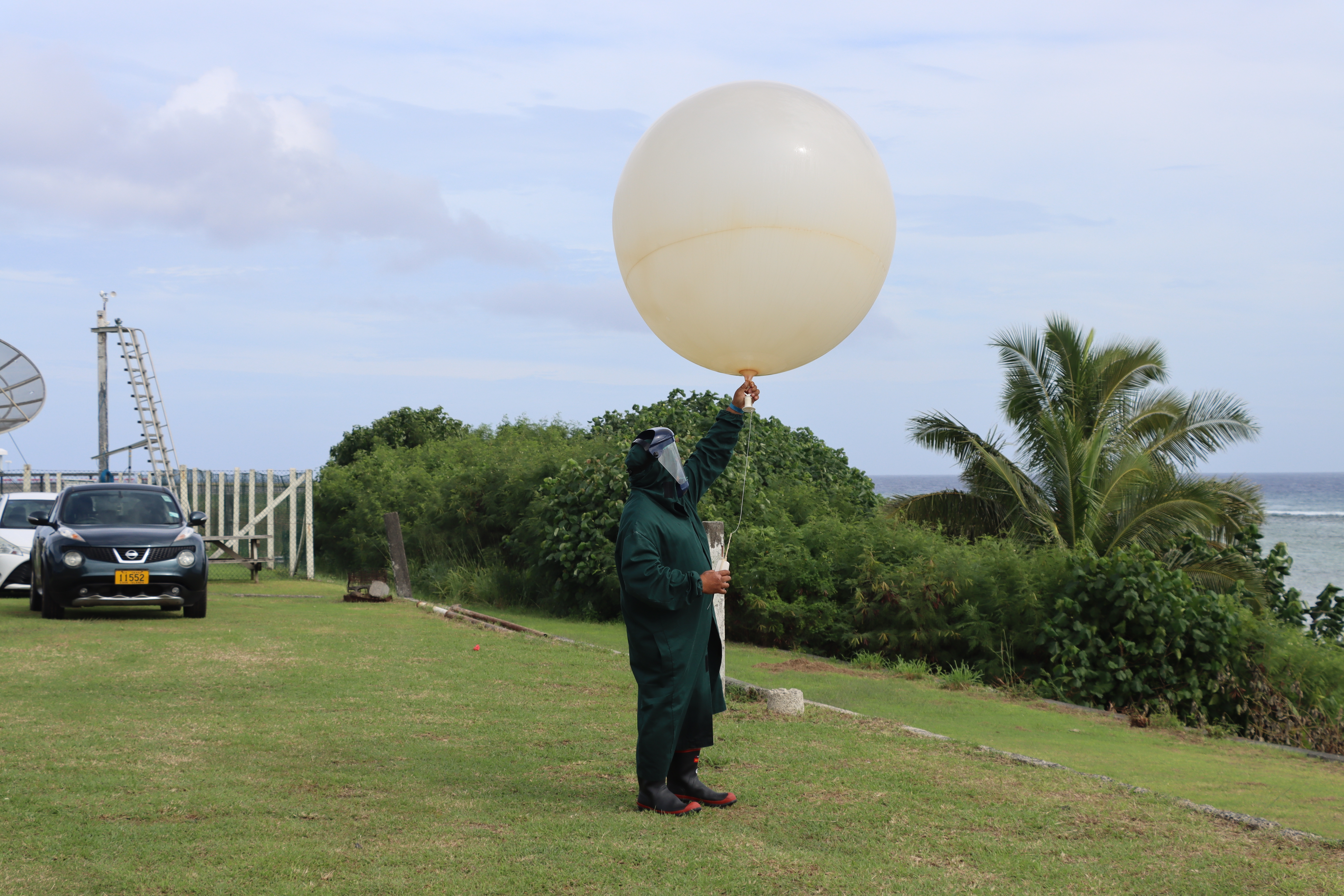
Tokelau’s meteorological and water services operate side by side. One meteorological officer is on each island, with a manager based on another island – five people in total, including Pasilio. Forecasts arrive twice daily from Fiji, Tokelau’s main provider, with Samoa as backup.
Yet uncertainty remains. “Sometimes, your projections and your forecast aren’t correct,” Pasilio recalls one person saying. “But in a way, I’m thankful that it is raining.”
For Tokelau, the message is clear: El Niño cannot be understood through regional averages alone. “Please localise it for us,” Pasilio says. “We still want our priorities and our needs to be recognised and to be addressed.”
Samoa braces as drought dries the north
Samoa is already feeling the early bite of a developing El Niño, with dry vegetation, dwindling rainfall, and small bushfires appearing across the islands months before the climate event is expected to reach its peak.
“We are starting to see some of the impacts,” Director of the Samoa Meteorological Service, Luteru Tauvale, says.
“In Samoa right now, there’s a lot of small bushfires because the vegetation is dry. We’ve had very little rainfall in the last two months.”
Tauvale says the latest information continues to favour a major El Niño event, potentially lasting through the end of the year and into early next year. But he cautions that forecasts must be constantly tested against changing conditions.
“The El Niño was forecast right from the beginning of the year, but you know that these are just forecasts,” he says. “We need to monitor the progress on a daily basis, on a two-week time frame, and on a monthly basis.”
The effects are not being felt evenly across Samoa. Local observations show the northern side of the islands is significantly drier than the south. The southern side remains greener because it faces the trade winds, which have brought fresh to strong breezes and occasional rain.
That uneven pattern is raising concerns for water supplies, agriculture and food security. Samoa’s ministries and agencies have begun activating response plans, including public awareness campaigns urging communities to conserve water. “The agricultural produce might be affected and the water supplies might be affected,” Tauvale says.
The government has also been briefed through the Disaster Advisory Committee, established under the Disaster Emergency Management Act and made up of chief executives from across government.
For Tauvale, public understanding is central to Samoa’s response. Information is issued in both English and Samoan, while memories of the devastating 1997–98 El Niño, including bushfires that destroyed parts of northern Savai’I, remain a powerful warning.
“El Niño is something else,” he says. “It’s a change that we should be concerned about.”
Preparation starts as El Niño peaks
El Niño is already underway, and meteorologists warn it is likely to intensify in the coming months.
In an update from Australia’s Bureau of Meteorology, Dr Simon McGree says both ocean and atmospheric indicators point to a “strong El Niño” declared in June, one that forecasts suggest will keep strengthening, potentially peaking toward the end of this year or in early 2027.
The rainfall outlook for the next two overlapping three‑month windows shows a stark divide across the Pacific. The western, northwest and southwest Pacific are forecast to receive significantly below-normal rainfall, while the central and eastern equatorial Pacific is expected to see significantly above-normal rainfall.
These patterns align with sea-surface temperature forecasts: warm waters over the central and eastern equatorial Pacific (reddish shading) are very likely to drive conditions that can contribute to marine heat stress and coral bleaching.
Sea level forecasts mirror the same spatial story. Central and eastern equatorial regions are predicted to experience higher-than-normal sea levels, while the western and parts of the northwest and southwest Pacific are expected to see negative sea-level anomalies. Some projections suggest declines could exceed “30 per cent metres below normal,” raising concerns for coral reefs and mangroves.
The warning is not only theoretical. McGree pointed to impacts during the 2016 El Niño, including cyclone activity in the northwest Pacific and costly consequences during the event’s second year when severe effects can arrive even after the El Niño has “ended.”
With many models indicating El Niño persistence into March–May 2027, officials stress that suppressed rainfall can linger for months afterwards. The challenge is magnified by a warming world, where past analogues may not fully capture what comes next.
“We need to consider the possibility that impacts may be unique,” Dr McGree says, supporting the case for urgent climate risk work.
Meanwhile, Pacific partners have begun activating ground arrangements for monitoring and preparedness, from water-shortage planning to tracking prolonged heavy rain.